
Acquiring a 3D terrestrial seismic survey is a complex project that unfolds in several successive phases, from site preparation to its restoration to its original condition. Here is the chronological sequence of field operations, structured around the major key stages:
1. Surveying and Line Layout
Before deploying any equipment, the site must be prepared to allow access for the teams and vibration sources.
- Topographic Staking: Using high-precision GPS (RTK), surveyors mark the exact location of each source point (vibrators/dynamite) and each receiving point (geophones).
- Line Permitting & Clearance: * Negotiating access rights with local landowners.
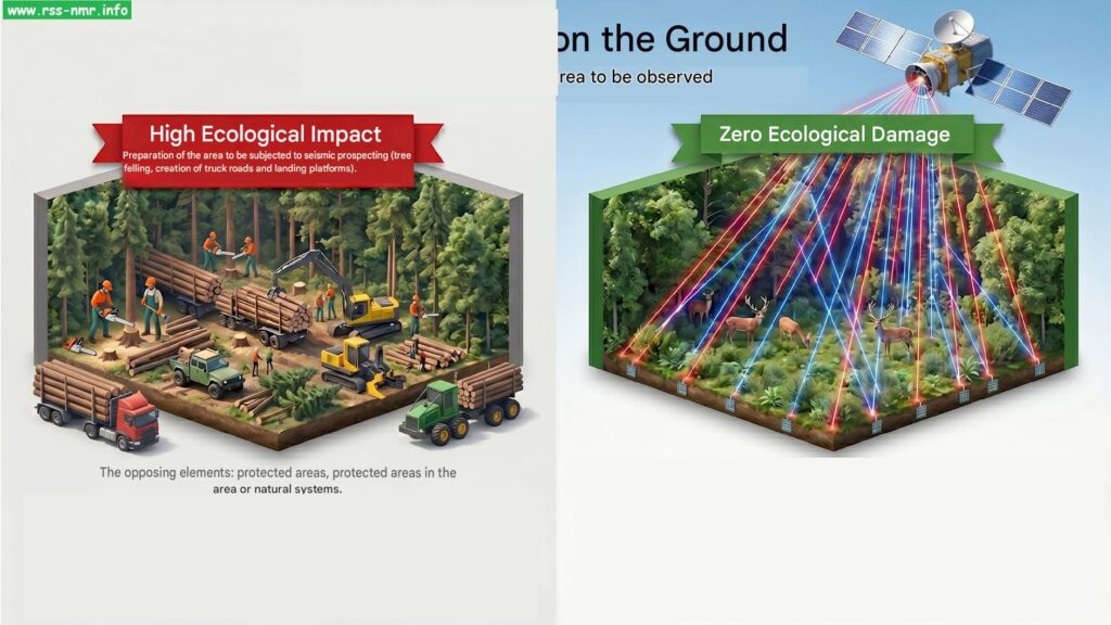
- Opening of narrow lanes (laylines) in areas of dense vegetation to allow the passage of cables and vehicles, while minimizing environmental impact (selective logging).
2. Deployment of the Listening Device (Recording)
This is the phase where the “net” that will capture the subsurface echo is installed.
- Installation of the Receivers: Deployment of thousands of ground sensors (geophones or autonomous nodes) connected by cables (or wirelessly) to a central recording laboratory (mobile lab).
- Quality Control: Testing of the lines to ensure that all sensors are transmitting data correctly and that there is no interference (wind, traffic).
3. Data Transmission and Acquisition
This is the core of the seismic operation. An acoustic wave is generated that propagates through the subsoil and reflects off the different geological layers.
- Energy Sources: Two main methods are used depending on the terrain:
- Vibrator Trucks (Seismic Vibration): These trucks press a heavy plate into the ground and emit a variable frequency signal (sweep). Ideal for open or flat terrain.
- Drilling and Dynamite (Seismic Explosives): In rugged areas (mountains, dense forests), small, lightweight drills bore holes (5 to 30 meters deep) into which small explosive charges are placed.
- Recording: With each blast or vibration, the mobile laboratory records the signals reflected by the subsoil by measuring the travel time of the waves.
4. Equipment Removal (Site Abandonment)
Once measurements are completed in an area, the equipment is moved (using the “rolling mat” method). When the entire 3D area is covered, the site is demobilized.
- Collection: Removal of all equipment (geophones, boxes, cables, batteries).
- “Zero Trace” Principle: No waste or equipment should remain on site.
- Securing: If dynamite blasts could not be detonated (failed blasts or blasts abandoned for safety reasons), they are neutralized and defused by experts according to strict protocols. Drill holes are filled and cemented to prevent water infiltration.
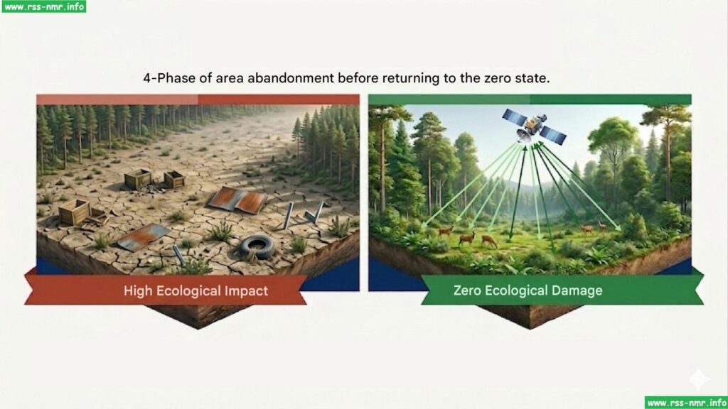
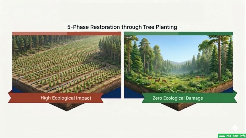
5. Environmental Restoration and Reforestation
This final phase aims to erase the human footprint and return the land to nature or its inhabitants in its original state.
- Cleaning and Reshaping: Restoration of soils compacted by vibratory trucks. Leveling of temporary tracks to prevent erosion caused by rain.
- Reforestation and Revegetation: * On the tracks opened in forested areas, replanting of previously selected native plant species is carried out (often from local nurseries funded by the project).
- Installation of natural barriers (branches, cut trunks) at the entrances to the former tracks to prevent access by vehicles and poachers, thus allowing fauna and flora to recolonize the area.
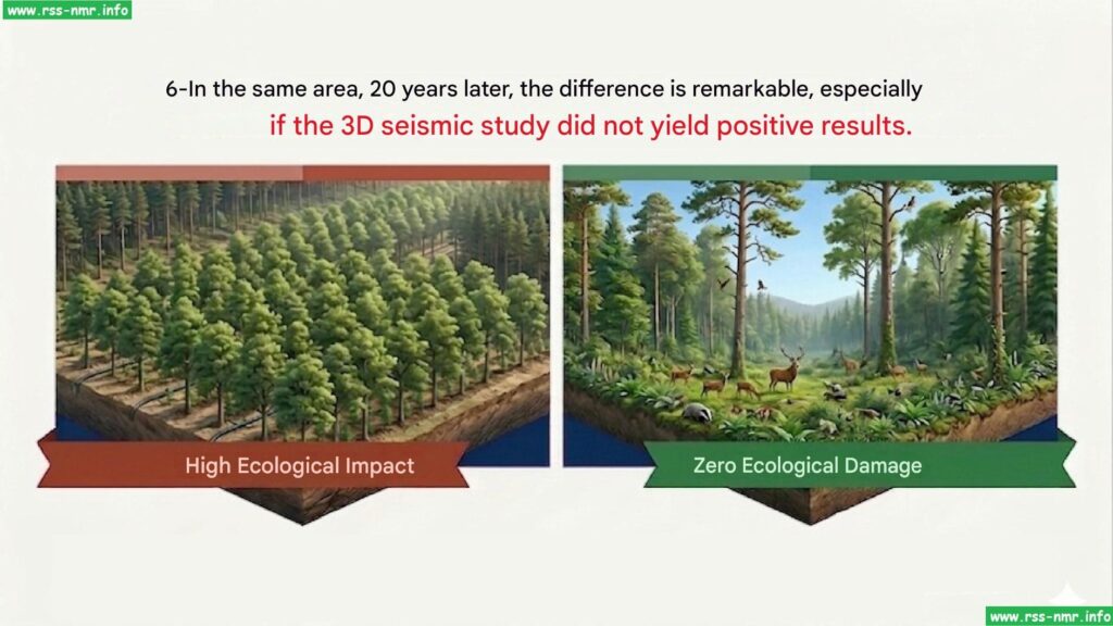
- Environmental monitoring (Post-audit): Regular inspections (sometimes over several years) are carried out to verify the proper recovery of vegetation and to ensure that no long-term damage (such as groundwater pollution) has been caused.